Smartpur: Digital Impact Platform Development for Rural India
Explore MoonDive’s digital impact platform development for Smartpur, with an interactive India map, centre pages, impact stories, and a role-based CMS.
- Client
- Smartpur
- Industry
- Social Impact & Rural Development
- What we built
- Web Development
- Year
- 2026
- Built with
- Next.js, React, Node.js
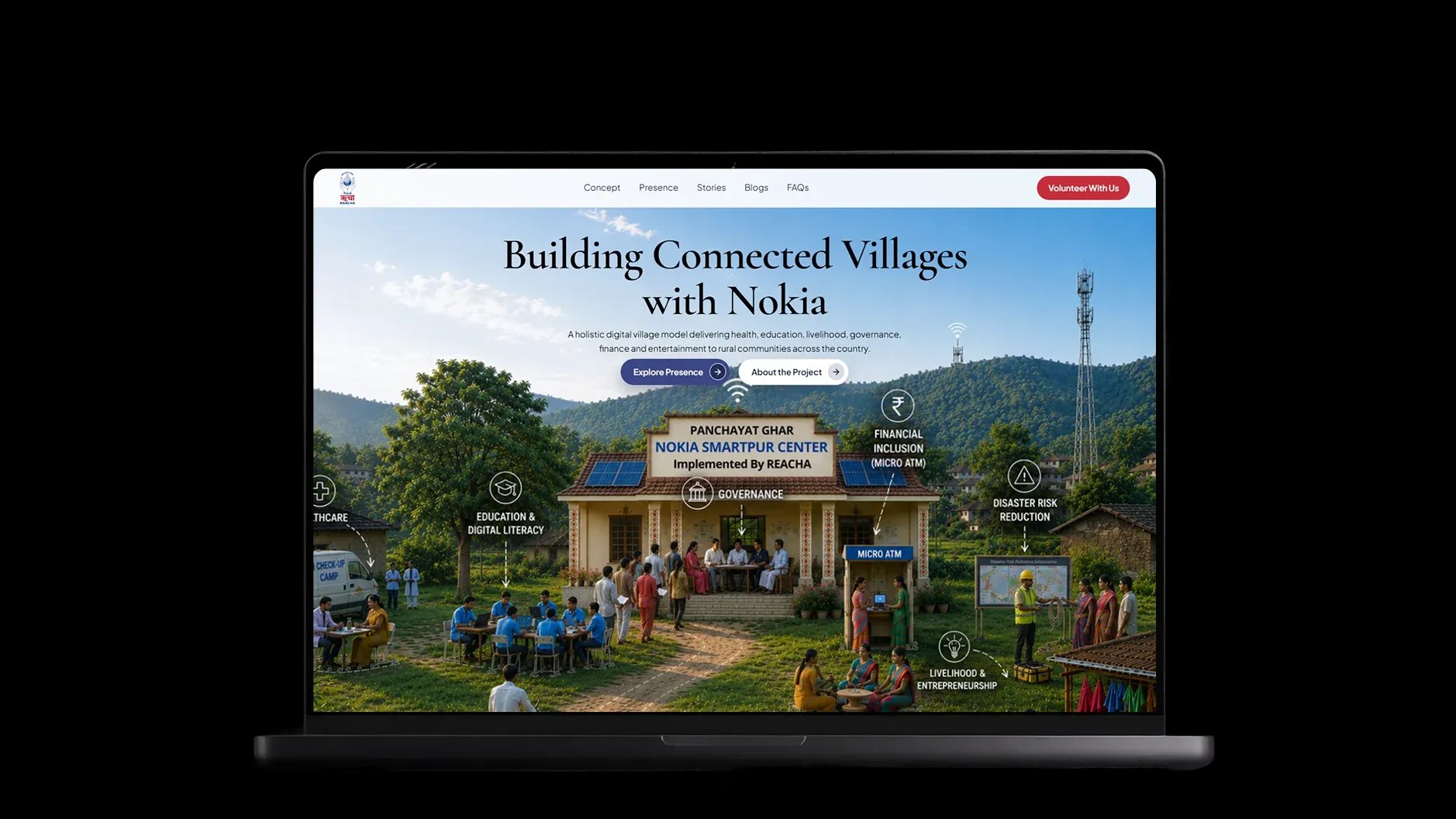
Building a Better Digital Experience
From identifying challenges to creating a scalable solution for Smartpur.
- Challenge
Smartpur’s impact was spread across states, districts, centers, and local updates. There was no single place to see the full picture.
- Process
We organized the experience around a simple journey: start with India, open a state, explore a centre, and discover its impact.
- Solution
We built an interactive public platform and a role-based admin system that REACHA can manage without regular developer support.
About Smartpur
- Next.js
- React
- Node.js
- Tailwind CSS
- CMS
- Admin Portal
- Map Integration by leaflet
Smartpur is Nokia’s flagship corporate social responsibility initiative, implemented on the ground by REACHA.
Read moreShow less
Smartpur is Nokia’s flagship corporate social responsibility initiative, implemented on the ground by REACHA. It supports rural communities through education, health, financial inclusion, governance, livelihood, and disaster risk reduction.
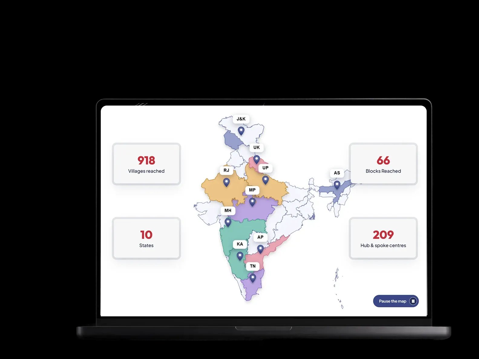
The programme reaches 918 villages through 209 Smartpur Centres across 10 states. Every centre does meaningful work, but that work was difficult to explore in one place.
MoonDive built a digital platform where visitors can see Smartpur’s reach on an interactive India map, explore states and centres, read impact stories, and understand the programme through real numbers and photographs.
Behind the public website, we also created an admin system that helps REACHA manage centre information, stories, blogs, videos, testimonials, galleries, and live programme statistics.
Technical Approach
Smartpur needed a scalable foundation to connect centres, stories, data, and users seamlessly.
- 01
Building an Interactive Map for a Large Network
Smartpur operates across hundreds of villages and centres, so displaying every location on a single map requires more than adding basic location markers. We built an interactive India map that organizes centre data by state, district, and location. Visitors can begin with a national view, select a state, and explore the centres operating there. The map loads location data dynamically, helping it remain responsive even as more centres are added. This made the map a visual representation of Smartpur’s reach and a practical navigation tool.
- 02
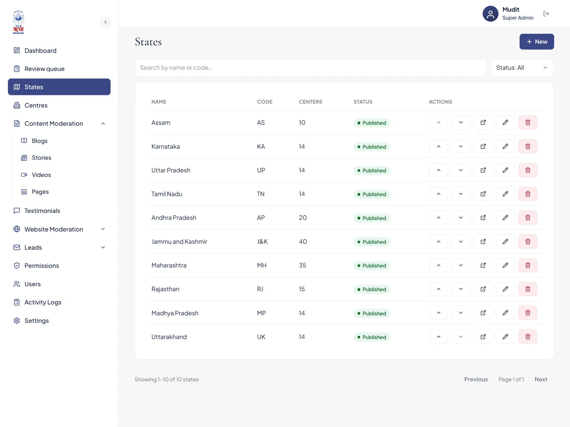
Creating a Scalable State and Centre Structure
Smartpur’s information is connected across several levels: states, districts, centres, programme pillars, activities, galleries, and impact stories. We created a structured data system that connects these different levels. Every centre is linked to its relevant state and district, while its activities, photographs, stories, and impact information are managed separately. This modular structure makes the platform easier to scale. REACHA can add new states, centres, or content without changing the platform’s core architecture.
- 03
Connecting Impact Data with Human Stories
The platform needed to present both measurable impact and the real stories behind it. These two types of content required different structures but still needed to appear as part of one connected experience. We developed separate content modules for programme statistics, impact stories, galleries, testimonials, and centre activities. Stories can be categorized by programme pillar, assigned to relevant locations, and marked as featured. This allows REACHA to present national-level numbers alongside local stories without manually rebuilding pages whenever new content is published.
- 04
Developing Role-Based Content Management
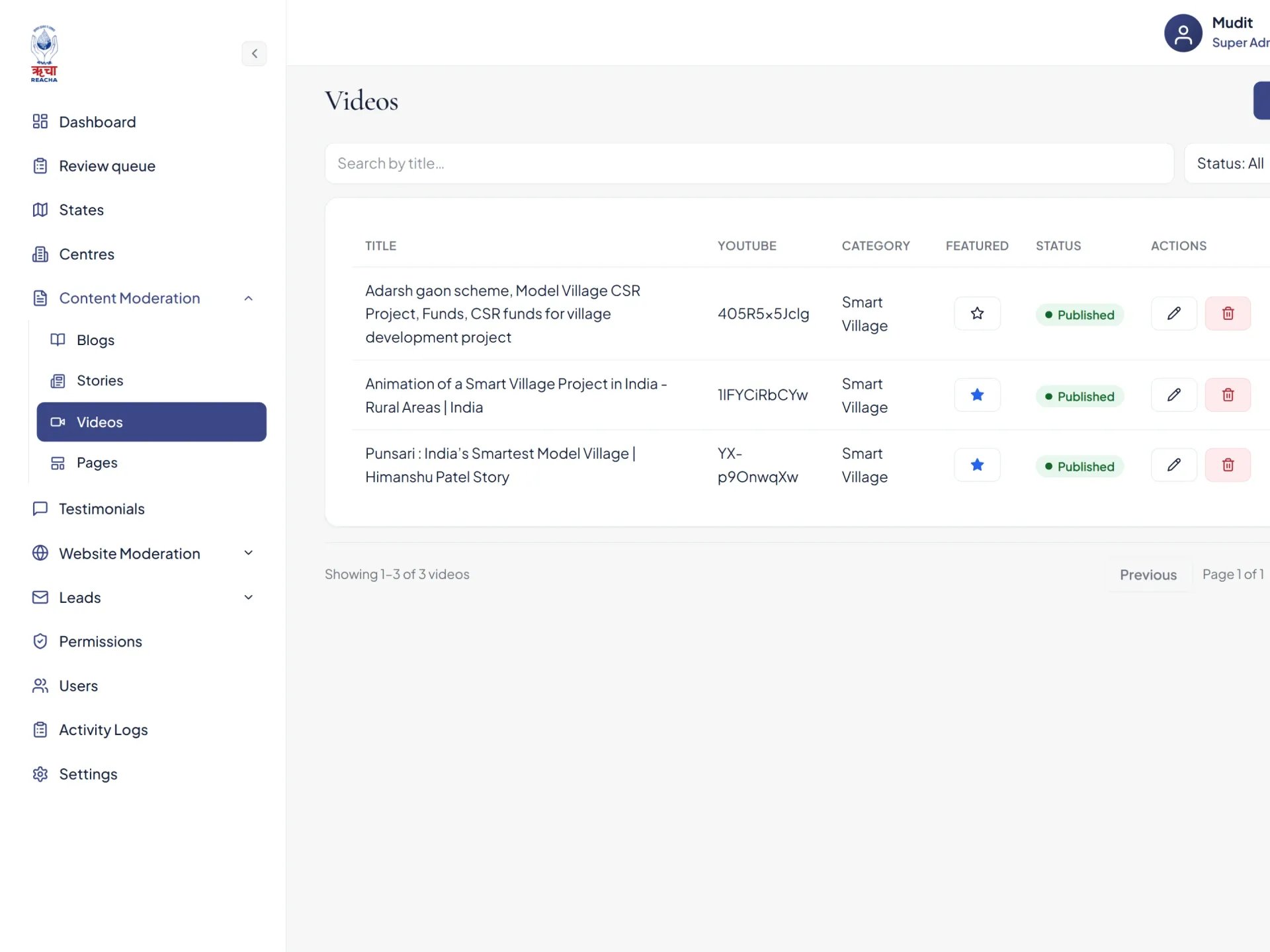
Smartpur content is managed by teams working across different states. Giving every user complete access would create security and content-control risks. We implemented role-based access for State Admins and Super Admins. State Admins can create and update content only for their assigned regions. Super Admins have platform-wide access and can manage users, states, centres, permissions, and publication decisions. This technical permission structure protects sensitive administrative functions while allowing regional teams to contribute content independently.
- 05
Building a Structured Review and Approval Workflow
Content created by regional teams needed to be reviewed before appearing on the public website. We built an approval workflow in which new content and edits are submitted to a central review queue. Super Admins can preview each submission, check the information, and approve or reject it. Once approved, the content is published directly to the live website. This reduces manual coordination, prevents unverified information from going public, and removes the need for developer involvement in routine updates.
- 06
Making a Data-Heavy Platform Fast and Easy to Use
Smartpur contains a large amount of information, including centre records, map locations, images, stories, statistics, videos, and programme pages. Loading everything at the same time could make the website slow and difficult to use. We organized the platform so that content is loaded according to the page and location being explored. Clear navigation, reusable content components, optimized media, and responsive layouts help the experience remain smooth across desktop, tablet, and mobile devices. The technical complexity stays in the background, while visitors experience a platform that feels simple, fast, and easy to navigate.
Scope of work
Step by step implementation
Research4 weeks
We understand Smartpur’s goals, audiences, programme structure, content, and approval needs.
Planning2 weeks
We organized the website into four levels: home, state hubs, centre pages, and supporting pages. .
Design2 weeks
We created a warm, clear, and credible interface led by the interactive India map and real photography.
Development3 weeks
We built the responsive website, centre discovery experience, content modules, and admin platform.
Testing2 weeks
We checked important journeys across devices and refined the map, content flow, forms, and publishing process.
Delivery2 weeks
We prepared the platform for launch and gave REACHA the tools to manage future updates independently.
Our Solution
A Connected Platform to Explore, Manage, and Showcase Smartpur’s Impact.
- 01
Build an Interactive Experience Around the India Map
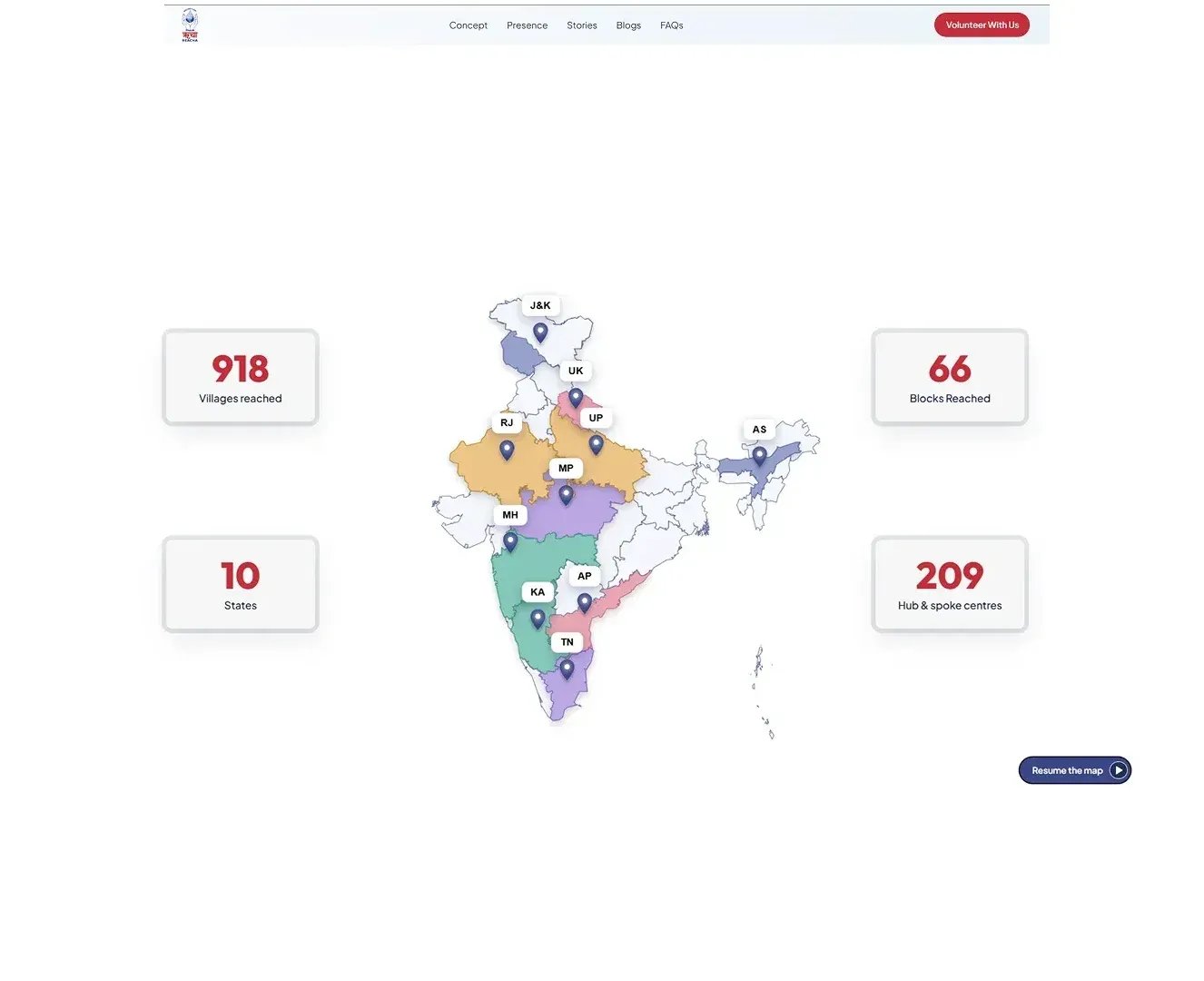
The interactive India map became the foundation of the Smartpur platform. Instead of presenting the programme’s locations through a long list, MoonDive created a visual experience that shows the states and centres where Smartpur is active. Visitors can begin with the national view, select a state, and explore the work taking place in that region. The map is connected with structured location data, allowing states and centre information to be managed through the admin platform. As Smartpur expands, new locations can be added without redesigning the entire experience. By combining navigation with data visualization, the map helps visitors understand the scale of the programme while giving them a clear starting point for exploring its centres, activities, and impact across India.
- 02
Create a Clear Journey from States to Individual Centres
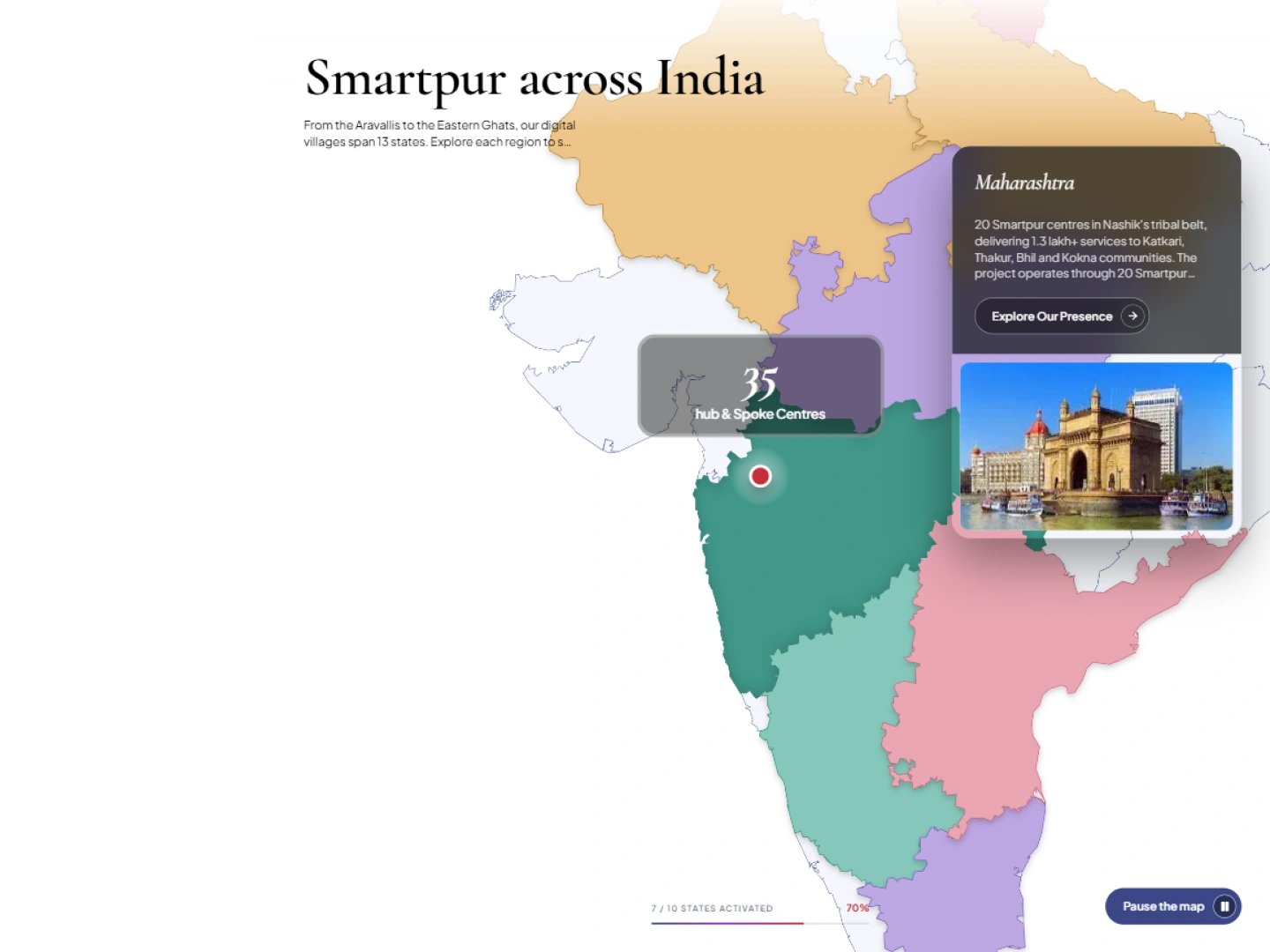
MoonDive creates the platform around a simple geographical journey. After selecting a state from the India map, visitors reach a dedicated state page containing its programme overview, important statistics, and a complete list of Smartpur Centres. They can then open an individual centre page to learn more about its location, activities, galleries, and impact stories. This structure prevents visitors from becoming overwhelmed by information from hundreds of centres. It also creates a consistent content system in which every state, district, and centre is properly connected. Each new centre can follow the same structure, making the platform easier to expand and maintain. Visitors can move naturally from the larger programme story to the work happening within a particular community without navigating through multiple disconnected pages
- 03
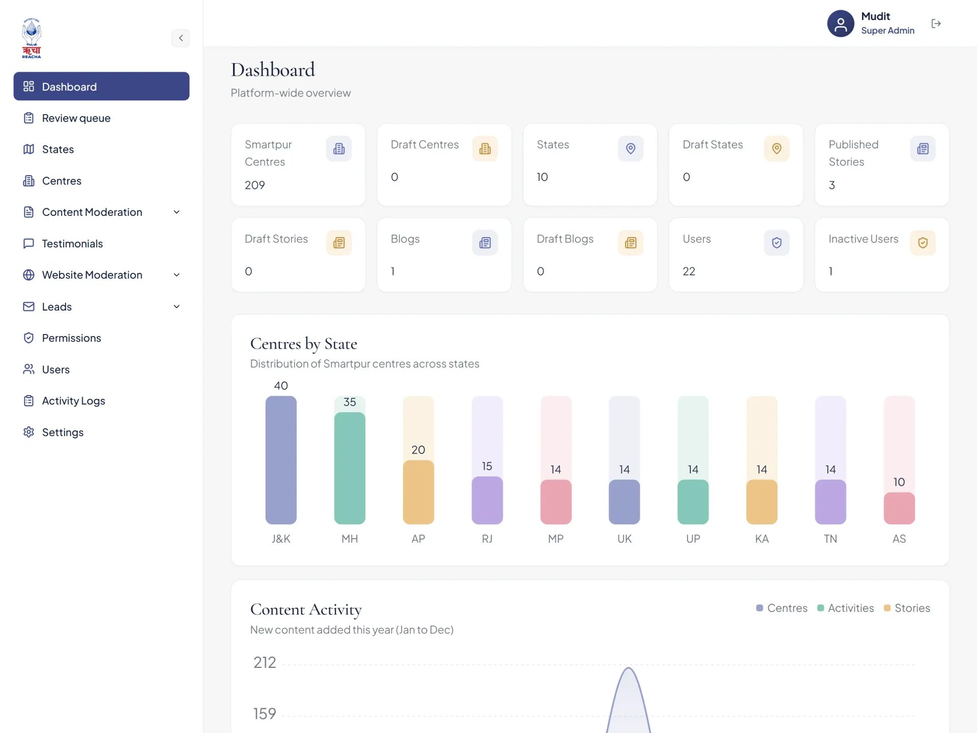
Build a Unified and Scalable Content System
Smartpur needed to manage several types of information, including states, centres, programme pillars, stories, blogs, photographs, videos, testimonials, and impact statistics. MoonDive created a modular content structure that allows each type of information to be managed separately while remaining connected across the platform. For example, an impact story can be linked to a specific centre, state, and programme pillar. The same story can then appear on the relevant centre page, state page, and featured-story section without being entered multiple times. This reduces duplicate work and keeps information consistent throughout the website. The structure also allows REACHA to add new content and locations as Smartpur grows, without requiring major technical changes or rebuilding existing pages.
- 04
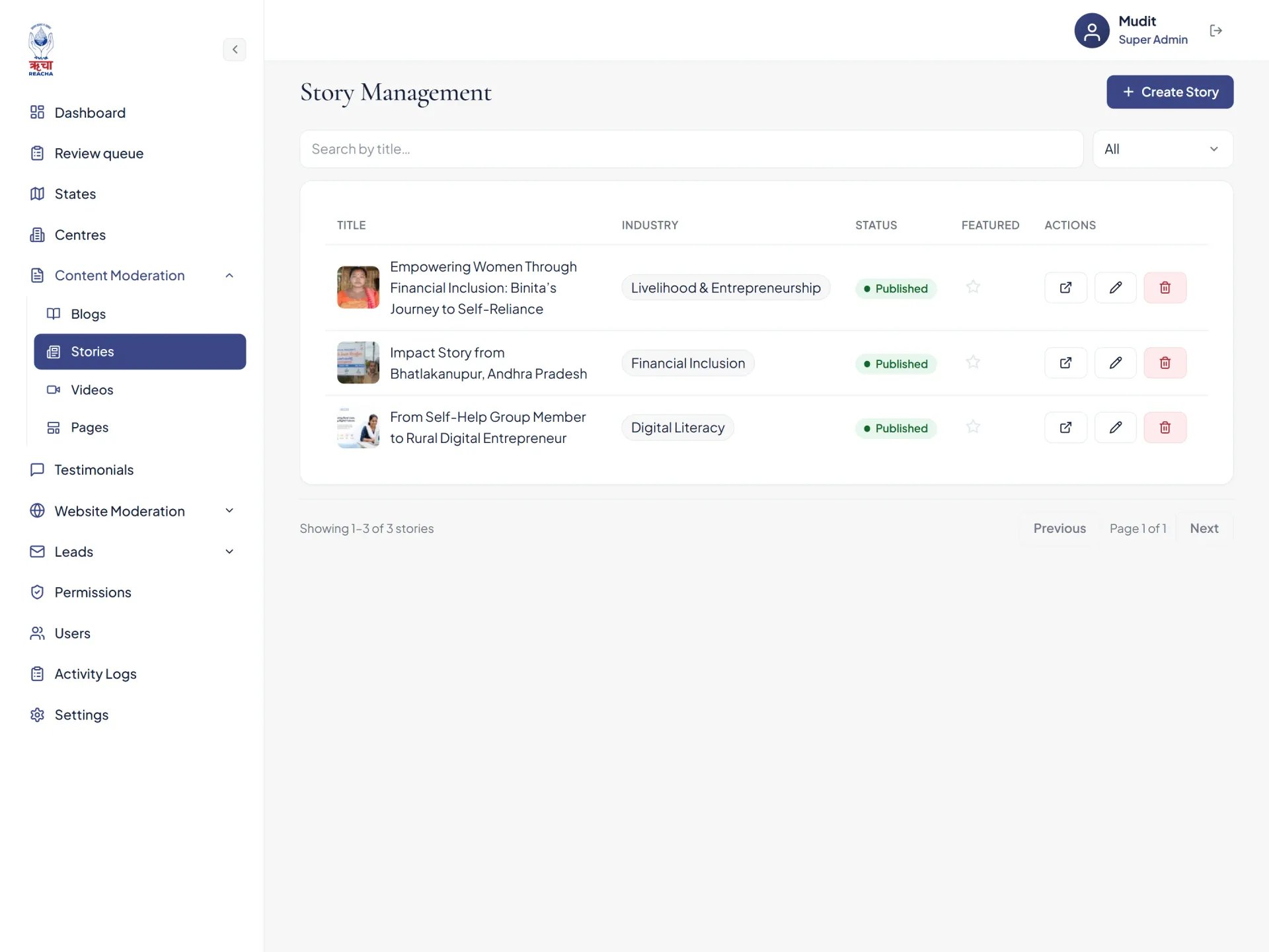
Bring Programme Data and Human Stories Together
MoonDive designed the platform to communicate both the scale and the human impact of Smartpur. Headline figures such as villages reached, active centres, citizens empowered, and programme outcomes are displayed prominently, helping visitors understand the size of the initiative. These figures can be updated through the admin platform so that the website continues to reflect the programme’s current reach. Alongside these numbers, the platform includes dedicated impact stories that show how Smartpur supports people and communities. REACHA can add photographs, assign stories to relevant programme pillars, connect them with centres, and choose which stories should be featured. This combination ensures that the website does not present Smartpur only through statistics. It gives every number a human context and turns programme data into a story visitors can understand and remember.
- 05
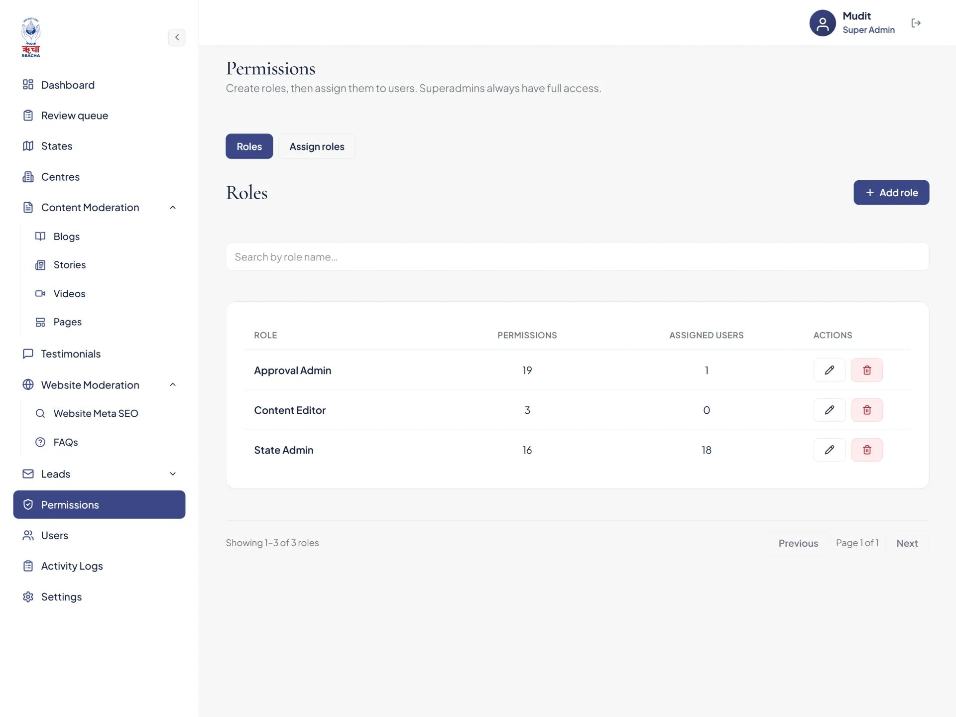
Develop Role-Based Content Management and Approvals
MoonDive developed a custom admin platform around the way REACHA manages content across different states. State Admins can create and update centre information, stories, blogs, galleries, and regional content for their assigned locations. Their access is limited to the areas they manage, helping protect information belonging to other regions. Super Admins have platform-wide control over users, states, centres, permissions, and publication decisions. Content submitted by State Admins enters a structured review queue where it can be previewed, approved, or rejected. Once approved, the content is published directly to the live website. This workflow gives regional teams the freedom to contribute while allowing REACHA to maintain accuracy, consistency, and editorial control. It also reduces the need for developers to handle routine content updates.
- 06
Make Sustainability and Solar Impact Easy to Understand
Smartpur’s sustainability work is an important part of the programme, especially in locations where access to reliable electricity can be challenging. MoonDive created a dedicated solar-energy section that presents this work through clear statistics, regional information, and simple visual elements. The section highlights figures such as solar-powered centres, installed capacity, clean electricity generated, and avoided carbon emissions. These numbers help visitors understand how renewable energy supports Smartpur’s long-term operations while reducing its environmental impact. Sustainability information is connected with the wider platform instead of being presented as an isolated report. This allows Smartpur to show how technology, community development, and clean energy work together to create centres that are more reliable, efficient, and prepared to serve rural communities over time.
- 07
Deliver a Responsive Experience Built to Grow
The Smartpur platform contains interactive maps, location records, photographs, stories, programme statistics, videos, and administrative workflows. MoonDive brought these elements together in a responsive experience that remains clear and easy to navigate across desktop, tablet, and mobile devices. Content is organized according to the page and location being explored, preventing visitors from receiving too much information at once. Reusable page structures maintain consistency across states and centres, while optimized media and responsive layouts support smoother performance across different screen sizes. The platform is also designed to accommodate new locations, stories, users, and programme data as Smartpur grows. The technical complexity stays in the background, giving visitors and administrators an experience that feels simple, reliable, and ready to scale.
The Results
A connected digital ecosystem designed to extend essential services to rural communities.
Core service areas
Health, education, livelihood, governance, finance & disaster risk reduction
Spoke centres per hub
Creating accessible digital touchpoints for rural communities
States reached
Extending digital services across diverse rural communities
More case studies.
HireGoat
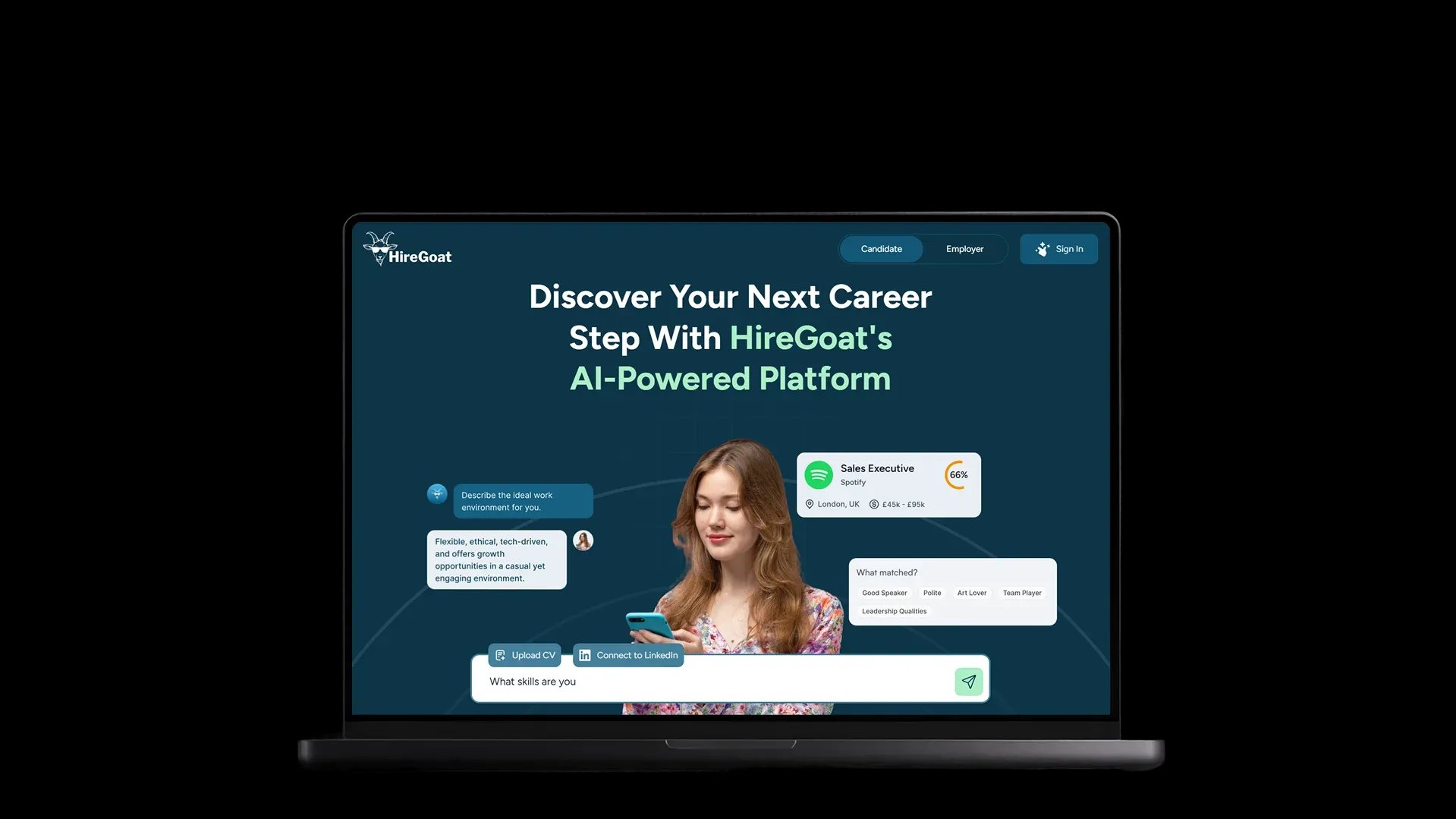
AI-powered job portal by MoonDive enhances hiring with smart matching, real-time feedback, and cultural fit scoring that faster, human, and personalized.Built with: MongoDB, React, Node.js, Next.js, OpenAIRead the case study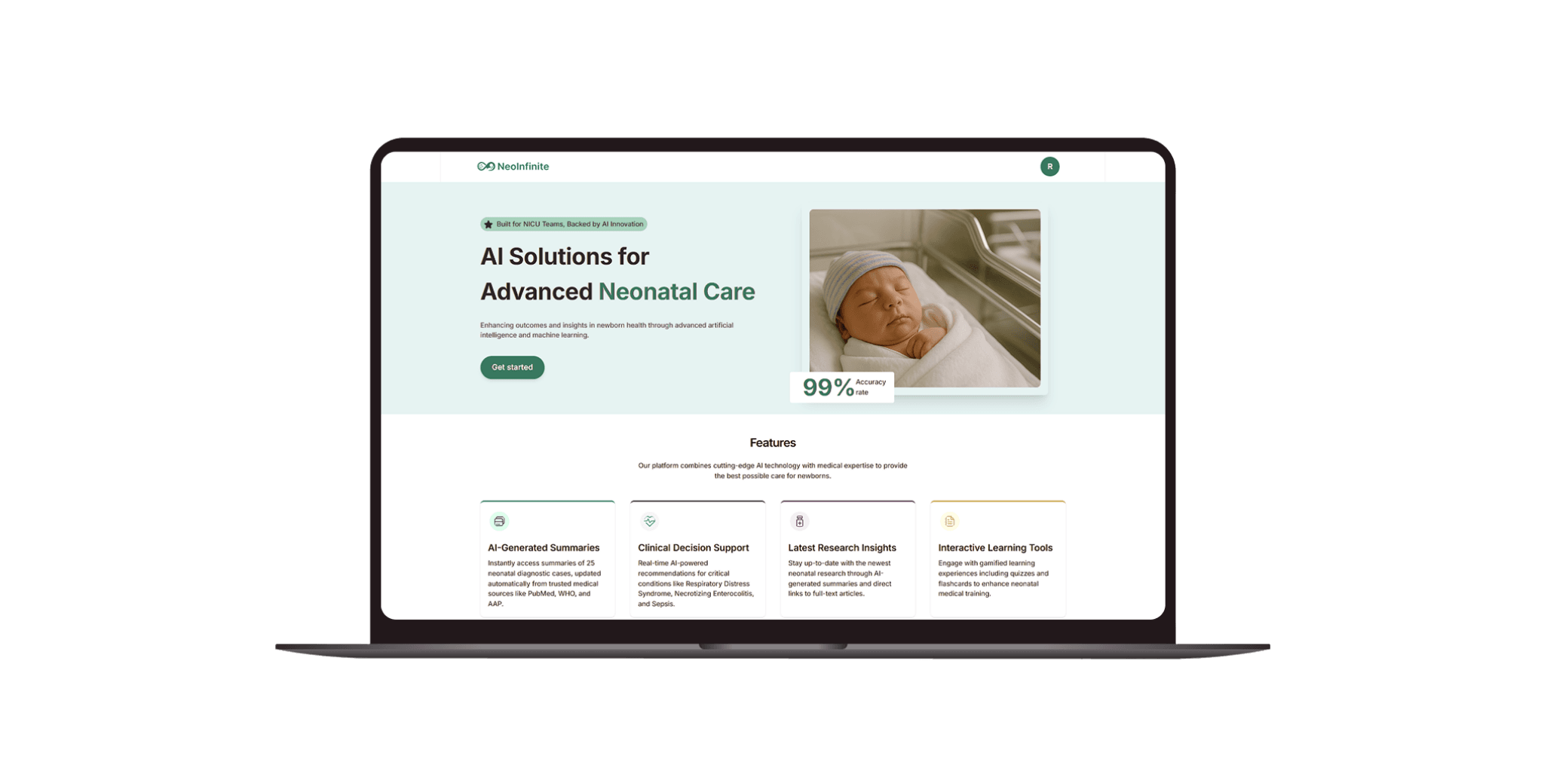
NeoInfinite
MoonDive’s AI neonatal platform boosts NICU care with real-time monitoring, smart insights, and parent engagement, built for speed and accuracy.Built with: React, Next.js, MongoDB, Node.js, OpenAIRead the case study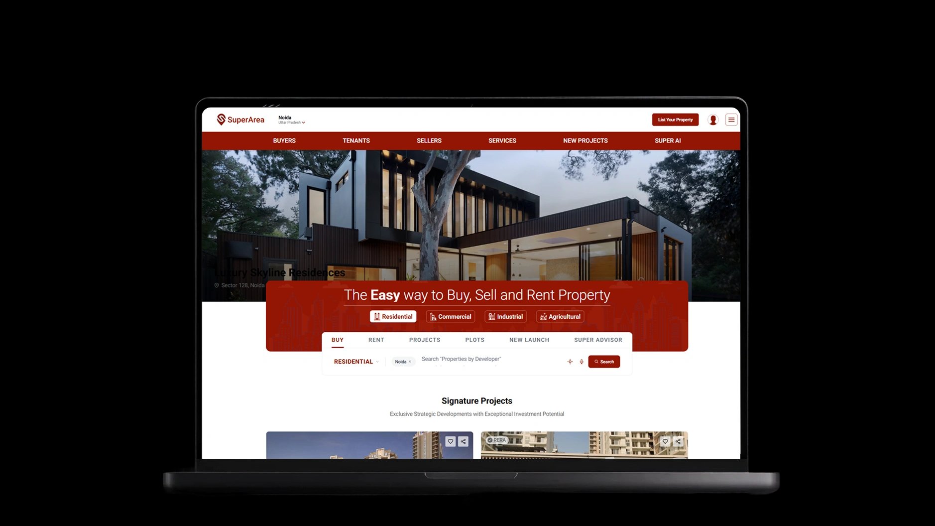
SuperArea
Discover how we built a cutting-edge AI-powered real estate platform, enhancing property search, user experience, and scalability for buyers and sellers.Built with: Next.js, React, Node.js, MongoDB, OpenAIRead the case study

What could we build together?
Bring us your challenge. We’ll bring the technology and expertise to move it forward.